TBD Se 256th Avenue, Umatilla, FL 32784
- $124,900






- List Price
- $124,900
- Status
- Active
- Days on Market
- 270
- Price Change
- ▼ $24,100 1775700805
- MLS#
- OM715016
- Lot Size
- 57,935
- Acres
- 1.33
- Total Acreage
- 1 to less than 2
- MLS Area Major
- Umatilla / Dona Vista
Property Description
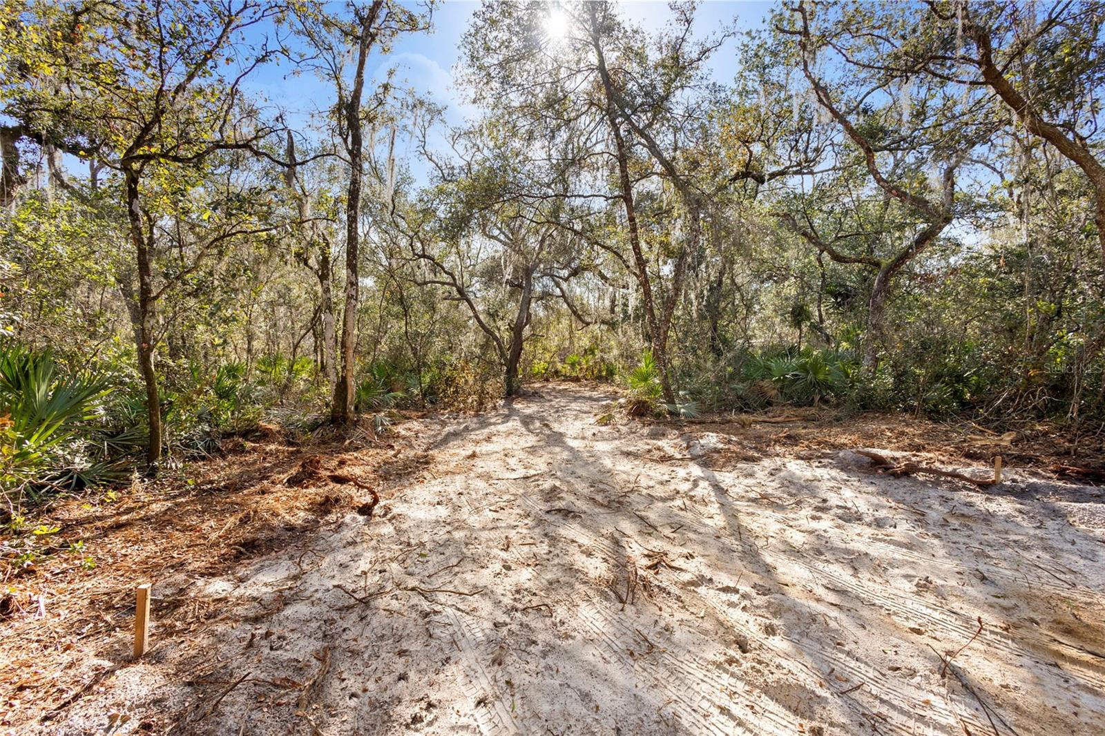
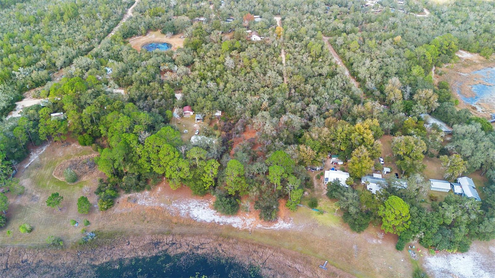
Your Wild Florida Dream Awaits – 1.33 Acres of Waterfront Freedom (Zoned A1). Escape the city, silence the notifications, and let the squirrels be your new HOA. Tucked away in the southern stretch of the Ocala National Forest, this 1.33-acre waterfront lot is the perfect place to build, plant, camp, glamp, fish, dream, or simply hide from your responsibilities (we won’t tell). With A1 zoning, this land gives your imagination full permission to run barefoot and free. Build your dream home. Place a manufactured home. Start a glamping empire. Grow a garden big enough to finally impress your in-laws. Or—if you’ve been waiting for a sign—this might just be the moment to create that tiny-home AirBnB village you’ve been doodling on napkins for years. Nestled right around the Big Bass Campground, you’ll be in good company with nature lovers, fishing fanatics, and hunters who know how to swap stories around a campfire. Or keep the land entirely for yourself and build the log cabin of your dreams complete with deer heads, singing bass plaques, and taxidermy. The property has been cleared and already equipped with well (operability unknown, but hey, that’s part of the adventure), the hard stuff is already started, just bring your ideas and maybe a toolbox to build a dock and spend your days fishing with a koozie in hand. This land has been in the owner’s family for many, many years, holding countless memories and meaning. Now, it’s ready for a new chapter with you and your future generations. Come write your story on this peaceful, private, beautifully wild slice of Florida. Opportunities like this don’t come around often… but when they do, they usually involve a lake, some trees, and a whole lot of potential.
/u.realgeeks.media/oakandsagerealty/header.png)
Additional Information
- Taxes
- $430
- Location
- Buildable, Cleared, In County, Level, Oversized Lot, Room For Pool, Rural, Unpaved, Unincorporated, Wooded
- Community Features
- No Deed Restriction
- Zoning
- A1
- Utilities
- Electrical Nearby, Water Available
- Pool
- No Pool
- Fences
- Chain Link, Partial
- Water View
- Lake
- Water Access
- Lake
- Water Frontage
- Lake Front
- Pets
- Allowed
- Flood Zone Code
- X & A
- Parcel ID
- 50867-000-00
- Legal Description
- SEC 20 TWP 17 RGE 26 COM 665.60 FT S FROM NW COR OF NE 1/4 OF SW 1/4 OF NE 1/4 FOR POB TH N 88-59-10 W 148.90 FT TH S 00-28-40 W 350 FT MORE OR LESS TO THE WATERS OF NICOTOON LAKE TH SELY ALONG AND WITH SAID WATERS OF NICOTOON LAKE 150 FT MORE OR LES S TO A POINT THAT IS S 00-28-40 W TO THE POB TH N 00-28-40 E 420 FT MORE OR LESS TO THE POB TOGETHER WITH FULL RIPARIAN RIGHTS IN AND TO LAKE NICOTOON LAKE SUBJECT TO A PERPETUAL ROW AND EASEMENT OVER AND ALONG THE E 10 FT OF THE N 180 FT AND THE N 1 0 FT OF THE ABOVE DESCRIBED PREMISES WHICH SAID ROW AND EASEMENT TO BE USED JOINTLY BY THE GRANTEES HEREIN AND ALL OTHER PROPERTY OWNERS IN THE SW 1/4 OF NE 1/4 FOR THE PURPOSE OF INGRESS AND EGRESS AT AND FROM THERE RESPECTIVE PROPERTIES
Listing courtesy of BASSETT PREMIER REALTY INC. 352-307-2925
Mortgage Calculator
StellarMLS is the source of this information via Internet Data Exchange Program. All listing information is deemed reliable but not guaranteed and should be independently verified through personal inspection by appropriate professionals. Listings displayed on this website may be subject to prior sale or removal from sale. Availability of any listing should always be independently verified. Listing information is provided for consumer personal, non-commercial use, solely to identify potential properties for potential purchase. All other use is strictly prohibited and may violate relevant federal and state law. Data last updated on